Salda Lake
 React
React
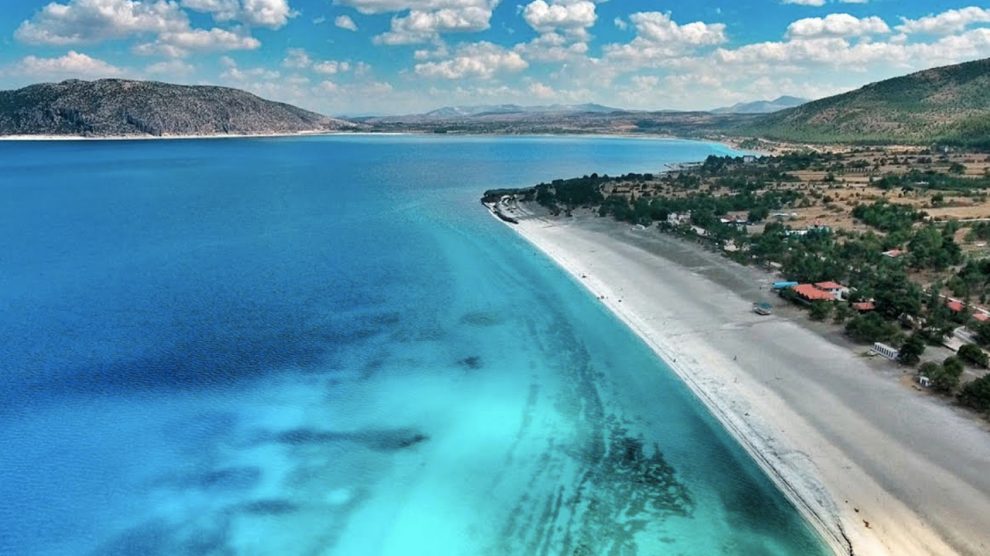
Salda Lake is located in the Salda Lake sub-basin within the Burdur Lakes Basin and in the southwest of the Lake District. It is surrounded by limestone and serpentine slopes covered by pine and oak forests. Small alluvial plains are located on the coast. Its water is a light tectonic lake and it is one of the deepest lakes in Turkey with a depth of up to 184 meters. Salda Lake is a low salty, highly alkaline lake. The lake gets its turquoise color from the white rocks of bacterial origin, which started to form in the archaic period and still continue to form, called stromatolite, which forms the lake floor. It is an internationally important wetland that meets the criteria of Important Plant Area, Important Natural Area and Important Bird Area with its endemic species. The habitat of Verbascum dudleyanum and Verbascum flabellifolium, a species of mullein, is limited to the southern shores of the lake. The lake shores with few settlements around are one of the important tourism centers in the region. (Eken et al. 2006).

Salda Lake is 6.8 kilometers wide, 9,186 kilometers long and is one of the deepest lakes in Turkey (maximum 184 meters). It is a closed basin lake because there is no stream exit from the lake. Lake Salda, with the Karakova (Salda), Dog, Doğanbaba, Değirmendere Streams, which are continuous under normal conditions, and the Kuruçay, Karadağ and Kayadibi Streams, which are seasonal, with the underground waters reaching the lake from the sinkholes around the tectonic pit it is in, the precipitations falling directly within the closed sub-basin boundaries are transferred to the surface flow. It is fed by the passing of water and the rain falling on it; It loses water by evaporation. The water level and area in the lake varies according to the years and seasons, depending on the rainfall and the volume of water held by the dams built on the rivers feeding the lake.
React


